


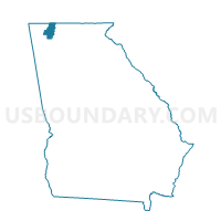
313CA - CARBONDALE Voting District, Whitfield County, Georgia
About
Outline

Summary
| Unique Area Identifier | 563127 |
| Name | 313CA - CARBONDALE Voting District |
| County | Whitfield County |
| State | Georgia |
| Area (square miles) | 27.87 |
| Land Area (square miles) | 27.83 |
| Water Area (square miles) | 0.04 |
| % of Land Area | 99.85 |
| % of Water Area | 0.15 |
| Latitude of the Internal Point | 34.67220520 |
| Longtitude of the Internal Point | -85.02322120 |
Maps


Graphs
Select a template below for downloading or customizing gragh for 313CA - CARBONDALE Voting District, Whitfield County, Georgia


Neighbors
Neighoring Voting District (by Name) Neighboring Voting District on the Map
- 129980 - RESACA Voting District, Gordon County, GA
- 2950953 - EAST ARMUCHEE Voting District, Walker County, GA
- 313DG - DUG GAP Voting District, Whitfield County, GA
- 313MC - MILL CREEK Voting District, Whitfield County, GA
- 313TI - TILTON Voting District, Whitfield County, GA
Top 10 Neighboring County Subdivision (by Population) Neighboring County Subdivision on the Map
- Dalton CCD, Whitfield County, GA (74,005)
- West Whitfield CCD, Whitfield County, GA (16,086)
- Sugar Valley-Resaca CCD, Gordon County, GA (6,536)
- Villanow CCD, Walker County, GA (2,187)
Top 10 Neighboring Unified School District (by Population) Neighboring Unified School District on the Map
- Whitfield County School District, GA (69,608)
- Walker County School District, GA (65,673)
- Gordon County School District, GA (39,599)
Top 10 Neighboring State Legislative District Lower Chamber (by Population) Neighboring State Legislative District Lower Chamber on the Map
- State House District 4, GA (56,709)
- State House District 3, GA (55,830)
- State House District 5, GA (53,590)
- State House District 2, GA (49,475)
Top 10 Neighboring State Legislative District Upper Chamber (by Population) Neighboring State Legislative District Upper Chamber on the Map
- State Senate District 54, GA (173,407)
- State Senate District 52, GA (168,885)
- State Senate District 53, GA (164,710)
Top 10 Neighboring 111th Congressional District (by Population) Neighboring 111th Congressional District on the Map
Top 10 Neighboring Census Tract (by Population) Neighboring Census Tract on the Map
- Census Tract 8, Whitfield County, GA (7,352)
- Census Tract 15, Whitfield County, GA (6,656)
- Census Tract 9702, Gordon County, GA (6,536)
- Census Tract 209.02, Walker County, GA (2,187)
Top 10 Neighboring 5-Digit ZIP Code Tabulation Area (by Population) Neighboring 5-Digit ZIP Code Tabulation Area on the Map
- 30721, GA (53,601)
- 30720, GA (26,895)
- 30728, GA (19,612)
- 30740, GA (8,600)
- 30735, GA (6,153)
- 30746, GA (1,223)